Ireland
Dublin Driving practice routes
Practise driving on the streets of Dublin on a 3D map — free, in your browser, with nothing to install.
Open Dublin in RoadariumThe simulator opens on the city map, where you choose any route.
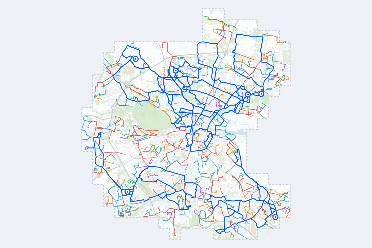
- 379Practice routes
- 1,176 kmLength of all routes
- 234Different roundabouts
- 1,353Named streets
Route types
First drive
Quiet streets and simple junctions — a few easy turns
- Routes: 73
- Typical length: 1.6 km
- Typical time: 3 min
Parking
Five marked parks in a row: at the kerb, forward and reversing in, then in a car park’s bays
- Routes: 80
- Typical length: 1.4 km
- Typical time: 3 min
Junctions
Give way, STOP and unmarked junctions on the side streets, with turns across the oncoming traffic — who goes first when there are no lights
- Routes: 70
- Typical length: 1.8 km
- Typical time: 4 min
Roundabouts
One or more roundabouts on the way
- Routes: 72
- Typical length: 3.3 km
- Typical time: 7 min
Rush hour
Busy avenues through the centre: traffic lights, lanes, turns across traffic
- Routes: 66
- Typical length: 3.6 km
- Typical time: 7 min
Driving test practice
A drive like the practical test: from a test centre and back where one is known, over the roads and junctions the examiner covers.
- Routes: 18
- Typical length: 18 km
- Typical time: 37 min
Test practice loops
The test drive here lasts 50–100 min. Each loop starts and finishes at the test centre.
| Loop | Test centre | Length | Time | Roundabouts | Traffic lights | Turns | Main streets |
|---|---|---|---|---|---|---|---|
| 01 | Dun Laoghaire/Deansgrange | 18 km | 35 min | 3 | 44 | 21 | Leopardstown Road, Newtownpark Avenue, Stillorgan Park, Pottery Road |
| 02 | Dun Laoghaire/Deansgrange | 18 km | 35 min | 1 | 38 | 25 | Merrion Road, Rock Road, Strand Road, Pottery Road |
| 03 | Dun Laoghaire/Deansgrange | 19 km | 38 min | 5 | 47 | 29 | Stillorgan Park, Monkstown Link Road, Pottery Road, Taney Road |
| 04 | Finglas | 18 km | 35 min | 6 | 40 | 44 | Finglas Bypass, North Circular Road, Phibsborough Road, Finglas Road |
| 05 | Finglas | 18 km | 37 min | 7 | 41 | 45 | Finglas Bypass, Ratoath Road, Jamestown Business Park, Cardiffsbridge Road |
| 06 | Finglas | 19 km | 37 min | 1 | 63 | 37 | Finglas Road, North King Street, Botanic Road, Ballygall Road East |
| 07 | Killester | 18 km | 36 min | 0 | 74 | 45 | Malahide Road, Annesley Bridge Road, Alfie Byrne Road, Howth Road |
| 08 | Killester | 18 km | 37 min | 1 | 69 | 37 | Annesley Bridge Road, Grove Road, Nicholas Street, Clontarf Road |
| 09 | Killester | 19 km | 38 min | 3 | 41 | 22 | Swords Road, Collins Avenue East, Collinstown Lane, Naul Road |
| 10 | Mulhuddart Maple House | 18 km | 37 min | 13 | 22 | 28 | Castleknock Road, Ratoath Road, Snugborough Road, Cappagh Road |
| 11 | Mulhuddart Maple House | 19 km | 37 min | 7 | 31 | 26 | Ballycoolin Road, Cappagh Road, Mellowes Road, Balbutcher Lane |
| 12 | Mulhuddart Maple House | 20 km | 40 min | 9 | 39 | 30 | Castleknock Road, Snugborough Road, Ballycoolin Road, Cappagh Road |
| 13 | Raheny | 18 km | 35 min | 4 | 32 | 25 | Clonshaugh Road, Baskin Lane, Malahide Road, Tonlegee Road |
| 14 | Raheny | 18 km | 36 min | 2 | 41 | 34 | Griffith Avenue, Howth Road, Collins Avenue Extension, Malahide Road |
| 15 | Raheny | 20 km | 39 min | 2 | 61 | 30 | Howth Road, North Circular Road, Clontarf Road, Clonliffe Road |
| 16 | Tallaght | 18 km | 35 min | 5 | 40 | 34 | Belgard Road, Fonthill Road South, Fonthill Road North, Tower Road |
| 17 | Tallaght | 19 km | 37 min | 5 | 36 | 39 | Greenhills Road, Grange Road, Limekiln Road, Main Street |
| 18 | Tallaght | 19 km | 38 min | 5 | 47 | 30 | Greenhills Road, Terenure Road West, Firhouse Road, Rathfarnham Road |
Streets on the routes
The streets the routes of Dublin use most.
- Swords Road
- Grange Road
- Malahide Road
- Howth Road
- North Circular Road
- Clontarf Road
- Main Street
- Kylemore Road
- Snugborough Road
- Greenhills Road
- Naul Road
- Navan Road
- Park Avenue
- Ratoath Road
- Saint Margaret's Road
- Vernon Avenue
- Ballinteer Road
- Ballycoolin Road
- Ballyfermot Road
- Blackcourt Road
- Boot Road
- Brookwood Avenue
- Cookstown Way
- Finglas Road
How it works
Open Dublin in Roadarium.
Pick a route on the city map, or plan your own.
Drive it in 3D with traffic, signs and lights, then see what to work on.