Australia
Brisbane Driving practice routes
Practise driving on the streets of Brisbane on a 3D map — free, in your browser, with nothing to install.
Open Brisbane in RoadariumThe simulator opens on the city map, where you choose any route.
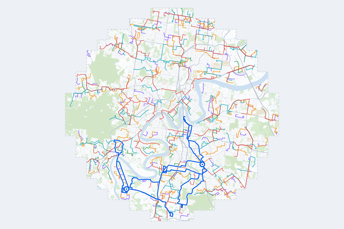
- 328Practice routes
- 807 kmLength of all routes
- 150Different roundabouts
- 1,357Named streets
Route types
First drive
Quiet streets and simple junctions — a few easy turns
- Routes: 26
- Typical length: 1.4 km
- Typical time: 3 min
Parking
Five marked parks in a row: at the kerb, forward and reversing in, then in a car park’s bays
- Routes: 82
- Typical length: 1.1 km
- Typical time: 2 min
Junctions
Give way, STOP and unmarked junctions on the side streets, with turns across the oncoming traffic — who goes first when there are no lights
- Routes: 79
- Typical length: 2.1 km
- Typical time: 4 min
Roundabouts
One or more roundabouts on the way
- Routes: 69
- Typical length: 2.8 km
- Typical time: 6 min
Rush hour
Busy avenues through the centre: traffic lights, lanes, turns across traffic
- Routes: 66
- Typical length: 3.3 km
- Typical time: 7 min
Driving test practice
A drive like the practical test: from a test centre and back where one is known, over the roads and junctions the examiner covers.
- Routes: 6
- Typical length: 13 km
- Typical time: 26 min
Test practice loops
The test drive here lasts 25–35 min. Each loop starts and finishes at the test centre.
| Loop | Test centre | Length | Time | Roundabouts | Traffic lights | Turns | Main streets |
|---|---|---|---|---|---|---|---|
| 01 | Greenslopes Transport and Main Roads Customer Service Centre | 11 km | 22 min | 4 | 6 | 30 | Ridge Street, Waterton Street, Sexton Street, Fairfield Road |
| 02 | Greenslopes Transport and Main Roads Customer Service Centre | 13 km | 25 min | 2 | 25 | 37 | Logan Road, Main Avenue, Wellington Road, Shafston Avenue |
| 03 | Greenslopes Transport and Main Roads Customer Service Centre | 13 km | 27 min | 1 | 19 | 33 | Tarragindi Road, Fernvale Road, Toohey Road, Logan Road |
| 04 | Sherwood Transport and Main Roads Customer Service Centre | 13 km | 26 min | 1 | 17 | 20 | Sherwood Road, Fairfield Road, Graceville Avenue, Softstone Street |
| 05 | Sherwood Transport and Main Roads Customer Service Centre | 13 km | 26 min | 1 | 19 | 22 | Wharf Street, Marlborough Street, Clarence Road, Station Road |
| 06 | Sherwood Transport and Main Roads Customer Service Centre | 14 km | 28 min | 3 | 10 | 28 | Sherwood Road, Muriel Avenue, Fairlie Terrace, Railway Parade |
Streets on the routes
The streets the routes of Brisbane use most.
- Wynnum Road
- Hamilton Road
- Moggill Road
- Ipswich Road
- Logan Road
- Payne Road
- Waterworks Road
- Rode Road
- Sherwood Road
- Creek Road
- Kingsford Smith Drive
- Oxley Road
- Samford Road
- Sandgate Road
- Cavendish Road
- Lomandra Drive
- Lutwyche Road
- Fairfield Road
- Fifth Avenue
- Nursery Road
- Old Cleveland Road
- Junction Road
- Lytton Road
- Albion Overpass
How it works
Open Brisbane in Roadarium.
Pick a route on the city map, or plan your own.
Drive it in 3D with traffic, signs and lights, then see what to work on.